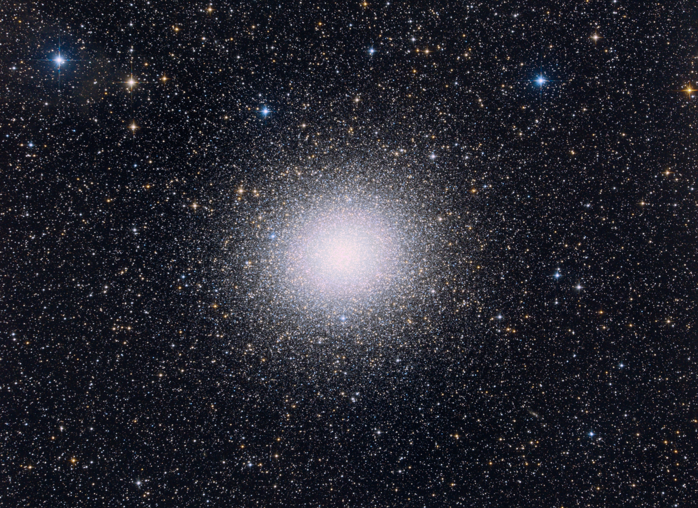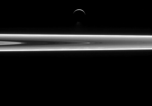
Enceladus
Az APOD mai felvételén a Cassini űrszonda felvétele látható az Enceladus holdról.

Az Enceladus (görög: Εγκέλαδος, a görög mitológiai alakot ejtsd: enkeládusz, de a latinizált holdnevet ejtsd (302. oldal): enceládusz) a Szaturnusz hatodik legnagyobb holdja. William Herschel fedezte fel 1789-ben. A hold a görög mitológiai Enkeladosz titánról kapta nevét. (Saturnus II, vagy S II Enceladus néven is ismert). Nevét, ahogy az utána felfedezett hét szaturnuszhold is, William Herschel fiától, John Herscheltől kapta 1847-ben.
A Naprendszer egyik legnagyobb fényvisszaverőképességű égitestje. Régóta ismert, hogy felületét vízjég borítja. De amíg a két Voyager űrszonda el nem haladt mellette, nagyon kevés információt lehetett tudni róla. A Voyager–2 fedezte fel, hogy a holdon kis mérete ellenére még nem olyan régen aktív, felszínt formáló erők működtek. A vizsgálatok során megállapították, hogy a kráterekkel sűrűn borított öreg felszínen kívül olyan tektonikusan kiformálódott területek is találhatók, amelyek 100 millió évnél korábban keletkeztek.

2004-ben Szaturnusz körüli pályára állt Cassini–Huygens űrszonda, amely további kérdésekre adott választ, és további megválaszolatlan kérdéseket vetett fel. 2005-ben többször is az Enceladus közelében repült el a Cassini egység, melyek során további felfedezéseket tettek. Ezek közé tartozik a hold déli-sarki régiójában felszálló vízpára. Ez a felfedezés, és az, hogy felszálló hőt is sikerült detektálni, továbbá, hogy a déli-sarki régióban igen kevés a becsapódási kráter, mind arra enged következtetni, hogy az Enceladus geológiailag még ma is aktív.
Az Enceladus egyike annak a három, a Naprendszer külső részében található égitestnek (az Io és a Triton holdjai mellett), amelyeken aktív vulkáni tevékenységet észleltek. Az Enceladus gázkitöréseinek elemzése során arra a következtetésre jutottak, hogy a felszín alatti folyékony víztömegből eredhetnek. A felszálló pára egyedi összetétele alapján arra a következtetésre jutottak, hogy az Enceladus az űrbiológiai vizsgálatok ígéretes célpontja lehet. A párakilövellésből arra következtettek, hogy az Enceladus felszínét elhagyó anyag lehet a Szaturnusz diffúz E gyűrűjének forrása.
További információk és részletek találhatók erről a Cassini-Huygens misszió weboldalán és a Cassini képfeldolgozó csapatának weboldalán.
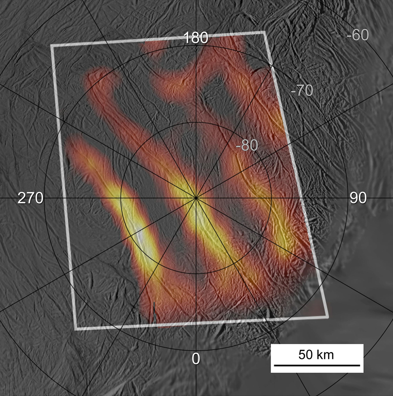
A Cassini űrszonda Enceladusról készített felvételein négy, megközelítőleg párhuzamosan futó, csíkszerű árokrendszer rajzolódott ki a déli pólus jégpáncélján. Az űrszonda mérései alapján a csíkok felszíne körül a környezetnél jóval magasabb hőmérséklet uralkodik.
A Doppler-effektus segítségével megállapították, hogy a hold déli pólusánál 30 kilométernyi jégtakaró alatt jó 10 kilométer mély víz található. A Cassini űrszonda mérései alapján az egész holdon folyékony víz található a szilárd kőzetmag és a felszíni jégtakaró között. Erre lehet következtetni az Enceladus “sajátos” billegő mozgásából. Lényegében úgy “imbolyog” a Szaturnusz körüli pályáján, ahogy azt egy vízzel töltött demizson tenné az autóban. Leegyszerűsítve a Szaturnusz vonzása hatására a hold felszíne alatt található folyékony víz elmozdul, ez okozza a hold billegő mozgását.
Az Enceladus és a Szaturnusz kapcsolata kölcsönös. Vagyis nem csak a Szaturnusz “szippantja el” az anyagot a holdról, de amennyiben a kutatók feltételezése helyes, a kilövelléseket a Szaturnusz okozza. Kicsit áttételesen a folyamat lényege az, hogy a Szaturnusz gravitációs ereje folyamatosan összenyomja, széthúzza és hajlítja a hold felszínét árapályerői révén. Ez, az amúgy is igen erős asztrogeológiai folyamat áll az Enceladus hőtermelése mögött, amely a folyékony víz jelenlétét eredményezi.
További írások az Enceladusról :
Az Enceladus északi pólusa
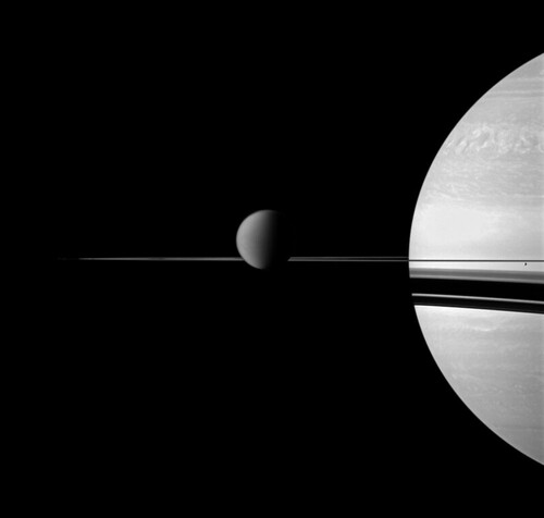
Szaturnuszsz, Titan, Enceladus és a gyűrűk